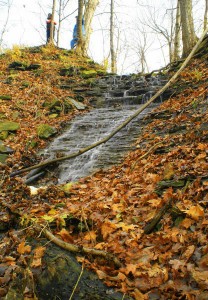
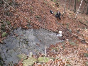
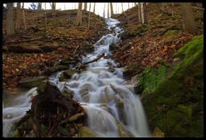
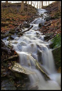
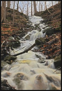
Olivieri Cascade is a cascade type waterfall. Water flows over the exposed rock surface at the top, then disappears under loose rocks and debris, emerging at a small drop section before disappearing again. Its crest width is 6 feet (1.8 metres) but widens out to 10 feet (3 metres) on the exposed rock face near the top. The total height including the top segment, the next section under the loose rocks and debris, and the vertical drop further down, is 45 feet (13.7 metres).
History
Olivieri Cascade was discovered by Chris Ecklund. The source of its water is the fields south of Ridge Road, and possibly a man-made pond as well. This will require checking by maps.
Brad Gautreau of the Friends of the Eramosa Karst sent in the following story about his own personal connection to Olivieri Cascade.
Many years ago -about 1973 or so- two friends and I ventured out to see Devil’s Punchbowl. We all lived in east Hamilton and went to Sir Winston Churchill High school together. A lot of the walk consisted of getting to the outer limits of the city, which back then was Highway 20.
Around Main Street and Highway 20, there was the old Gulliver’s Travels to the south and the newly opened East Square to the north.
We continued south up Highway 20 past Battlefield Park area.
Our trek to the Devil’s Punchbowl was a whole day event. We stopped at the Market at the top to buy some well deserved snacks and drinks. Instead of going back the way we came up, which was through the Punchbowl Falls valley, we went West. There was an old road there and a “hidden” wood lot to the southwest of the falls area.
This wood lot is actually split into two separate valleys. Being the explorers that we were, we wanted to see what was over the next hill. We did not understand at the time what we were missing. Had we walked over the next hill we would have come across the valley of what is now called Olivieri Cascade on the City Of Water falls web page. We did not make the climb because of time, and energy. We never did go back to that part. I have been to Devil’s Punchbowl many times since then.
This area is well-covered by city topographical maps, but remains a challenge to hands-on explorers, and I suspect it is still as it was 35 years ago: undisturbed and undiscovered in some parts.
Thirty-five years later, after seeing the Waterfalls page, my curiousity about the area I’d overlooked returned. Google Earth shows a clear valley in the area that I suspected would be a creek. Where there are creeks and Escarpment edges, there are waterfalls. I asked Chris to look into this for me.
Now we have the 115th water fall on the list. Thanks Chris.
I am looking forward to seeing more photos of this area, and plan on venturing out this winter when the ground is frozen.
Brad Gautreau
How to get there
This waterfall is located in the Stoney Creek section of Hamilton, on private property in the ravine on the east side of Centennial Parkway, south of the the train tracks. It is opposite Billy Green Falls. Park at Battlefield Park and walk up the trail and over the tracks staying close to Centennial and then head east into the ravine till you reach the falls.
Olivieri Cascade Photo Gallery
